MODIS albedo

MODIS components and albedo


MODIS (Moderate Resolution Imaging Spectroradiometer, NASA) is an instrument aboard the Terra and Aqua satellites of the NASA. It acquires data in broadband and in several spectral bands, from which among others, three parameters (fiso, fvol, and fgeo). These parameters are components of the Bidirectional reflectance distribution function (BRDF) exploited within CAMS McClear to derive the ground albedo.

MODIS maps and webservices
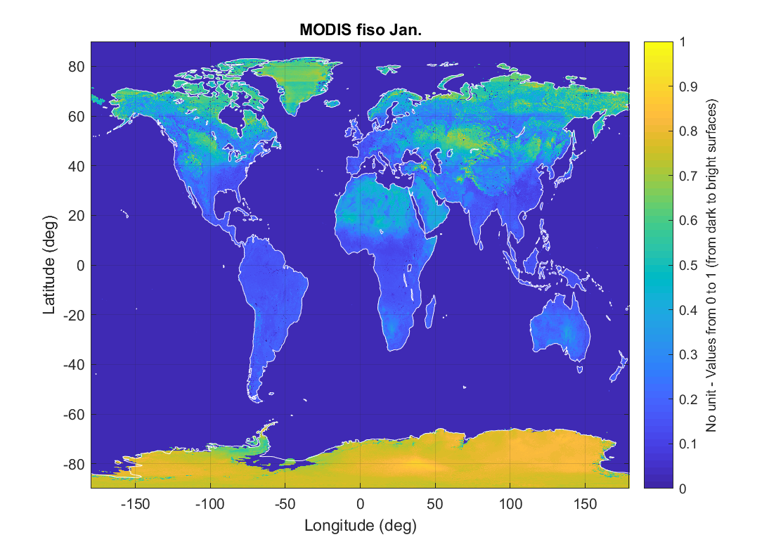
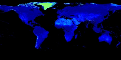
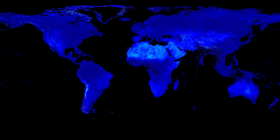
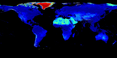
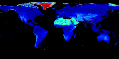
MAPS

Fiso, fgeo and fvol components:

  • "fiso" describes the isotropic part of the bidirectional reflectance distribution function (BRDF);
  • "fgeo" and "fvol" are linked to the viewing and illuminating geometry and describe the anisotropic part of the BRDF. How to use these parameters to compute the ground albedo is decribed in the reference document.

Grid description:

  • 3600 rows and 7200 columns
  • Geog coverage: from -89.975° to 89.975° in latitude, and from -179.975° to 179.975° in longitude
  • Spatial resolution: 1/20° = 0.05° in both directions = approx. 5 km

Downloads per component:

FISO:

FVOL:

FGEO:

Download maps in HDF5 format

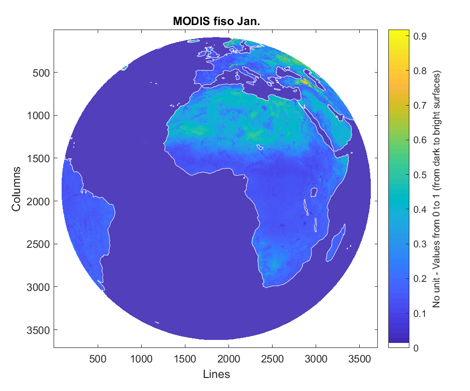
NB: MSG projection illustrations have been generated in the projection after 2012-12-06


PNG: example of MODIS fiso map in WGS84


PNG: example of MODIS fiso map in MSG projection


GeoTIFF: example of MODIS fiso map displayed in QGIS

(Click on the images to magnify)


Other MODIS resources

MonthlyO.I.E. - MINES ParisTech is proposing a series of 12 maps of the BRDF parameters that have been filled for gaps.
Maps are also available as images (png format) for display. Color table is the same for all images for a given parameter, allowing analysis of changes throughout the year. The MODIS data sets are worldwide but restricted to land.They exhibit other irregular data gaps in time and space.


MODIS fiso July


MODIS fiso December

Historical daily

The MODIS data is available in a 0.05 degree Climate Modeling Grid from the year 2000 until about the last 15 days :

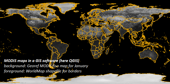
Find more information on the different MODIS data sets:

  • MCD43C1 provides the three model weighting parameters (isotropic, volumetric, and geometric) used to derive the Albedo (MCD43C3) and BRDF (MCD43C4) products. Each model parameter is available as a separate layer for MODIS spectral bands 1 through 7 as well as the visible, near infrared (NIR), and shortwave bands. Along with the 30 parameter layers there are ancillary layers for quality, local solar noon, percent finer resolution inputs, snow cover, and uncertainty.
  • MCD43C2 provides the three model weighting parameters (isotropic, volumetric, and geometric) computed from snow-free retrievals. Each model parameter is available as a separate layer for MODIS spectral bands 1 through 7 as well as the visible, near infrared (NIR), and shortwave bands. Along with the 30 parameter layers there are ancillary layers for quality, local solar noon, percent finer resolution inputs, and uncertainty.
  • MCD43C3 provides black-sky albedo (directional hemispherical reflectance) and white-sky albedo (bihemispherical reflectance) at local solar noon. Black-sky albedo and white-sky albedo values are available as a separate layer for MODIS spectral bands 1 through 7 as well as the visible, near infrared (NIR), and shortwave bands. Along with the 20 albedo layers are ancillary layers for quality, local solar noon, percent finer resolution inputs, snow cover, and uncertainty.
  • MCD43C4 removes view angle effects from directional reflectances to model the values as if they were collected from a nadir view at local solar noon. These NBAR values are calculated from MCD43C1. The product includes separate NBAR layers for MODIS spectral bands 1 through 7 as well as ancillary layers for quality, local solar noon, percent finer resolution inputs, snow cover, and uncertainty.


Combined MODIS BRDF Albedo parameters 1 band 1 data from the MCD43C1 product across the globe, August 2, 2018


Combined MODIS BRDF Albedo parameter 1 band 1 data from the MCD43C2 product across the globe, August 2, 2018


Combined MODIS BRDF Albedo black-sky albedo band 1 data from the MCD43C3 product across the globe, August 2, 2018


Combined MODIS BRDF Albedo nadir reflectance band 1 data from the MCD43C4 product across the globe, August 2, 2018


Publications

Lefèvre et al. 2013Lefèvre M., A. Oumbe, P. Blanc, B. Espinar, B. Gschwind, Z. Qu, L. Wald, M. Schroedter-Homscheidt, C. Hoyer-Klick, A. Arola, A. Benedetti, J. W. Kaiser, and J.-J.  Morcrette, 2013. "McClear: a new model estimating downwelling solar radiation at ground level in clear-sky conditions", Atmos. Meas. Tech., 6, 2403-2418, doi:10.5194/amt-6-2403-2013.McClear


Blanc et al. 2014Blanc P., Gschwind B., Lefevre M., Wald L., 2014. "Twelve monthly maps of ground albedo parameters derived from MODIS data sets". In Proceedings of IGARSS 2014, held 13-18 July 2014, Quebec, Canada, USBKey, pp. 3270-3272.MODIS, ground reflectance, albedo

Content: Presentation of the monthly maps of MODIS parameters (fiso, fvol and fgeo) used to generate albedo for each instant in the year, derived from holy maps of collected MODIS maps (holes due to clouds).


Tournadre et al. 2018Tournadre B., B. Gschwind, C. Thomas, L. Saboret, P. Blanc, 2018. "Characterizing the confidence in a gap-free static atlas of monthly-averaged BRDF parameters derived from MODIS MCD43C1 v5", Poster at EGU General Assembly.MODIS, ground reflectance, albedo