Rescue in-situ data
CHECK AND RESCUE in situ measurements with solar and meteorological data from satellite imagery services |
Service description - Our expertise, in pictures
Ground measurements are essential to collect radiation actually received at an exact geographical location. They are also mandatory to produce bankable reports to fund solar projects. This represents a significant investment for companies and universities to install, maintain, collect in real time and process such measurements. It might happen that, at the end of the acquisition period, quality is disappointing and the requested reliability is not available.
Service description: increase the value of your data
Your ground measurements (pyranometer, pyrheliometer, radiometers, solar cells, spectrophotometers...) will be carefully inspected and confronted to other datasets to detect and finally correct all potential artefacts in the measurements. In that purpose, we exploit four types of graphs which are described on this SoDa page.
Lead time and prices
Lead time and prices are very dependant on the quality of the data. An initial fee will be apply to provide a first insight concerning the data and evaluate the quantity of work requested on our side. Typical lead time for an instrument with a satisfying quality is approximately 5 working days.
Supplied results
The corrected time series is sent in the format requested by the user. An email to list all the observations, corrections, and warnings is also sent.
Options:
- long term satellite time series
- long term satellite time series calibrated using the reliable measurements
- provision of an official report with all the observations, corrections, and warnings.
Our expertise, in pictures
Please find below illustrations to depict corrections applied to your data:
- Merge data contained in different files,
- Detect and correct time shifts
- Discard non plausible values
- Set night and negative values to 0
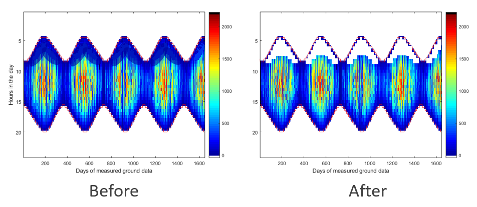
- Identify and discard shadowed moments.
Merge your data: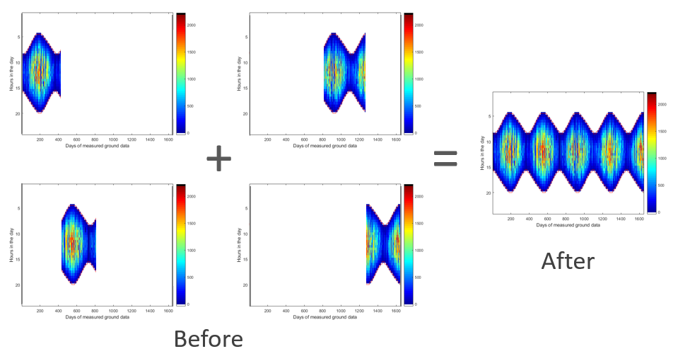 | Merge your ground data to handle only a single file per station | |
Detect and correct time shifts: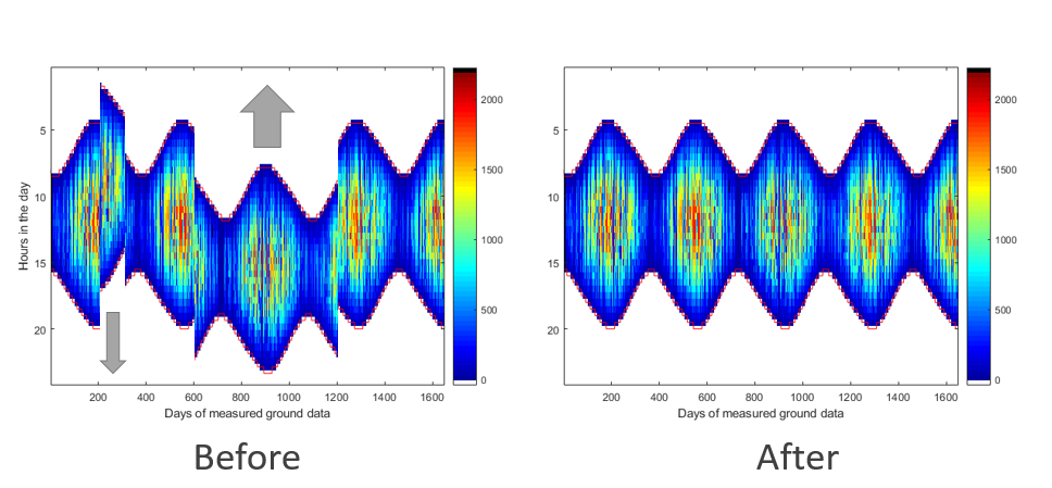 | Detect time shifts according to a temporal assumption (for instance: I want my data in Legal Time, or Universal Time) | |
Discard night values: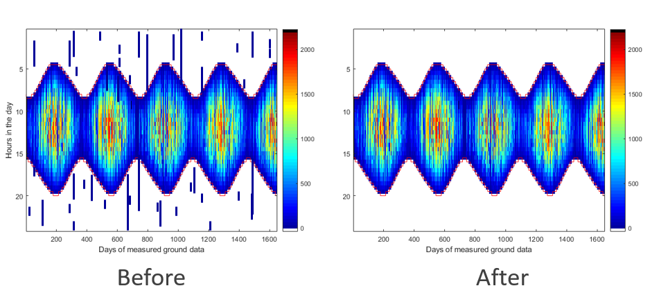 | Night values are generally noise | |
Discard non-plausible data: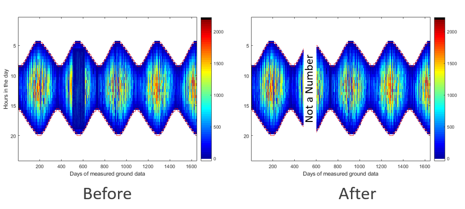 | Discard non-plausible data by defining thresholds and protocol adapted to the measured variable. As an example, please refer to the quality check procedure to qualify Global Horizontal Irradiation, Direct Normal Irradiation or Diffuse Horizontal Irradiation and to the associated validation protocol. | |
Discard shadowed instants: | Shadowed instants can be detected by using heat maps like on these pictures, and confirmed by taking a look at the "one-day graph" and to the "Shadow map". As the measurements are partially masked, these data need to be discarded to be compared to other datasets, or within the framework of the calibration of long-term satellite-derived radiation values using these measurements. |