Free Maps
FREE MAPS |
Available for immediate download
- Shapefiles
- Download free GADM world's administrative boundaries for use in GIS and similar software. Administrative areas in this database are countries and lower level subdivisions.
- Download the last QGIS version (current is QGIS "Las Palmas" 2.18.0, released on 2016-10-21)
| Country | Download | Framework | More Info | Last update | ||
|---|---|---|---|---|---|---|
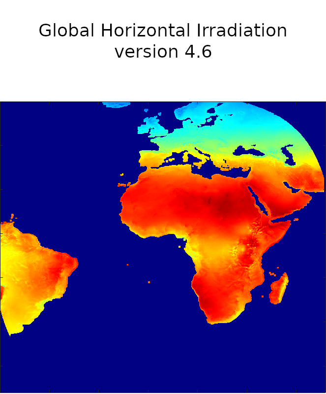
Europe, Africa, Middle-East and Brasil | Download for free CAMS Radiation Volume over MSG field of view (2004-2023): |  | - | April 2021 | ||
| Algeria |
|  |  | Oct. 2015 | ||
| Egypt |
|  |  | Oct. 2015 | ||
| France (+Corsica) |
| ARMINES / MINES ParisTech / Transvalor - www.SoDa-pro.com - Jan. 2015 |  | Jan. 2017 | ||
| Lybia |
|  |  | Dec. 2015 | ||
| Mauritania |
|  |  | Oct. 2015 | ||
| "Middle East": Jordan, Israel, Lebanon, and Palestine National Authority |
|  |  | Dec. 2015 | ||
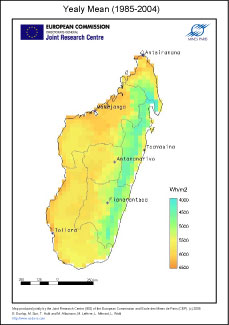
Madagascar | Yearly average of daily sums of global horizontal irradiation in kWh/m², averaged on the period (1985-2004). From satellite imagery, HelioClim-1 database. Download the jpeg monthly averages maps for March, June, September, and December. | copyright European Commission - Mines ParisTech / Armines 2005. | 2009 | |||
| Moldova |
| ARMINES / MINES ParisTech / Transvalor - www.soda-pro.com - Jan. 2016 |  | Jan. 2016 | ||
| Morocco |
|  |  | Oct. 2015 | ||
| Namibia | ARMINES / MINES ParisTech / Transvalor - www.SoDa-pro.com - Jan. 2015 |
| Jan. 2015 | |||
| Nigeria |
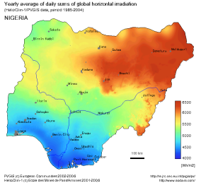
| PVGIS copyright European Commission 2002-2006 and HelioClim-1 copyright Mines ParisTech / Armines 2001-2006. | - | Nov. 2016 | ||
| South Africa | ZAF_adm0.zip southafrica_MSG_centers.zip mask-south-africa.zip | ARMINES / MINES ParisTech / Transvalor - www.SoDa-pro.com - Jan. 2015 |
| Jan. 2015 | ||
| Syria |
|  |  | Dec. 2015 | ||
| Tunisia |
|  |  | Oct. 2015 | ||
| Turkey |
|  |  | Jan. 2016 | ||
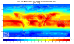
| WORLD |
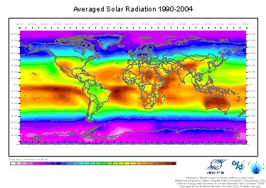
| ARMINES / MINES ParisTech - www.soda-pro.com - 2006 | - | Nov. 2016 | ||
| ARMINES / MINES ParisTech - www.soda-pro.com - 2006 | - | Nov. 2016 | ||||
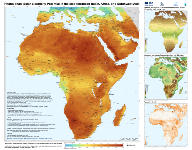
| AFRICA | PVGIS copyright European Commission 2001-2008 and HelioClim-1 copyright Mines ParisTech / Armines 2001-2008. | - | Nov. 2016 |
More information |
Different  Qgis projects were generated to fulfill the requirements of the SolarMedAtlas project. Please find below the description of the layers available in each Qgis projects.
Algeria
- Algeria_rivers
- Algeria_electric_lines_diva (not very reliable)
- Algeria_electric_lines_osm (reliable)
- Algeria_electric_lines_Transvalor (reliable)
- Algeria_substations (Osm completed by Transvalor)
- Algeria_cities
- Algeria_lakes
- Algeria_borders
- Algeria_BNI: yearly averaged HelioClim-3 version 5 Direct Normal Irradiation map at 1km, taking into account the shadowing effect of the far horizon (SRTM). Projection: WGS84. coordinates of the upper left corner (-8.68°, 37.09°), spatial step: 0.0083° corresponding to approx. 1km, number of longitudes: 2479, number of latitudes: 2175. Image tiff in uint16, missing value: 65535
- Algeria_GHI: idem Global Horizontal Irradiation
- Algeria_SRTM: same bounding box as the radiation raster layers
- Algeria_globcover: land description
Egypt
- Egypt_rivers
- Egypt_electric_lines (credits: Osm, Diva and Transvalor)
- Egypt_substations (Osm completed by Transvalor)
- Egypt_cities
- Egypt_lakes
- Egypt_borders
- Egypt_BNI_horizon1: yearly averaged HelioClim-3 version 5 Direct Normal Irradiation map at 1km, taking into account the shadowing effect of the far horizon (SRTM). Projection: WGS84. coordinates of the upper left corner (-24.69°, 31.66°), spatial step: 0.0083° corresponding to approx. 1km, number of longitudes: 1466, number of latitudes: 1160. Image tiff in uint16, missing value: 65535.
- Egypt_GHI_horizon1: idem Global Horizontal Irradiation
- Egypt_SRTM: same bounding box as the radiation raster layers
- Egypt_globcover: land description
France
- Shapefile of borders
- Localization of the centers of the Meteosat pixels in France
- KMZ file with the locations of the Meteofrance stations measuring the Global Radiation. Download this information also in CSV file.
Lybia
- Lybia_borders
- Lybia_towns
- Lybia_substations_Osm_completedby_Transvalor
- Lybia_lakes
- Lybia_rivers
- Lybia_electric_lines_Diva (corrected by Transvalor, reliable)
- Lybia_electric_lines_Osm (reliable)
- Lybia_electric_lines_Transvalor (reliable)
- Lybia_BNI: yearly averaged HelioClim-3 version 5 Direct Normal Irradiation map at 1km, taking into account the shadowing effect of the far horizon (SRTM). Projection: WGS84. Coordinates of the upper left corner (25.66°, 42.10°), spatial step: 0.0083° corresponding to approx. 1km, number of longitudes: 2298, number of latitudes: 754. Image tiff in uint16, missing value: 65535.
- Lybia_GHI: idem
- Lybia_SRTM: same bounding box as the radiation raster layers
- Lybia_Globcover: land description
- Lybia_slope (computed from SRTM)
Mauritania
- Mauritania_rivers (No lakes in this country)
- Mauritania_electric_lines_Osm (NB: the layer of electric lines from Diva was not relevant on this country)
- Mauritania_substations
- Mauritania_cities
- Mauritania_borders
- Mauritania_BNI_horizon1: yearly averaged HelioClim-3 version 5 Direct Normal Irradiation map at 1km, taking into account the shadowing effect of the far horizon (SRTM). Projection: WGS84. coordinates of the upper left corner (-17.08°, 27.29°), spatial step: 0.0083° corresponding to approx. 1km, number of longitudes: 1471, number of latitudes: 1506. Image tiff in uint16, missing value: 65535.
- Mauritania_GHI_horizon1: idem Global Horizontal Irradiation
- Mauritania_SRTM: same bounding box as the radiation raster layers
- Mauritania_globcover: land description
Middle East: Jordan, Israel, Lebanon, and Palestine National Authority
- MiddleEast_borders
- MiddleEast_cities
- MiddleEast_substations
- MiddleEast_lakes
- MiddleEast_rivers
- MiddleEast_electric_lines_diva (not reliable)
- MiddleEast_electric_lines_osm (reliable)
- MiddleEast_BNI: yearly averaged HelioClim-3 version 5 Direct Normal Irradiation map at 1km, taking into account the shadowing effect of the far horizon (SRTM). Projection: WGS84. Coordinates of the upper left corner (34.20°, 34.69), spatial step: 0.0083° corresponding to approx. 1km, number of longitudes: 611, number of latitudes: 660. Image tiff in uint16, missing value: 0.
- MiddleEast_GHI: idem
- MiddleEast_SRTM: same bounding box as the radiation raster layers
- MiddleEast_Globcover
Moldova
- Moldova_borders
- Romania_borders
- Ukraine_borders
- Moldova_cities
- Moldova_horizon1_HC3v5_GHI_YearAv: yearly map of Global Horizontal Irradiation, averaged over the year Feb. 2004 to Dec. 2014. Spatial resolution 1 km, taking into account the shadowing effect of the far horizon. Projection: WGS84. Coordinates of the upper left corner (26.62°, 48.49°), spatial step: 0.0083° corresponding to approx. 1km, number of longitudes (columns): 425, number of latitudes (lines): 364. Image tiff format Uint16, missing value: 0.
Morocco
- MOROCCO_electric_lines (credits: osm and Transvalor)
- MOROCCO_substations (completed by Transvalor)
- MOROCCO_cities
- MOROCCO_lakes
- MOROCCO_borders
- MOROCCO_BNI_horizon1: yearly average HelioClim-3 version 5 Direct Normal Irradiation map at 1km, taking into account the shadowing effect of the far horizon (SRTM). Projection: WGS84. Coordinates of the upper left corner (-17.11°, 35.92°), spatial step: 0.0083° corresponding to approx. 1km, number of longitudes: 1933, number of latitudes: 1819. Image tiff in uint16, missing value: 65535.
- MOROCCO_GHI_horizon1: idem Global Horizontal Irradiation
- MOROCCO_SRTM: same bounding box as the radiation raster layers
- MOROCCO_globcover: land description
Syria
- Syria_borders
- Syria_substations (completed by Transvalor)
- Syria_lakes
- Syria_rivers
- Syria_electric_lines_osm (reliable)
- Syria_electric_lines_diva (not reliable)
- Syria_BNI: yearly averaged HelioClim-3 version 5 Direct Normal Irradiation map at 1km, taking into account the shadowing effect of the far horizon (SRTM). Projection: WGS84. Coordinates of the upper left corner (35.72°, 37.32°), spatial step: 0.0083° corresponding to approx. 1km, number of longitudes: 799, number of latitudes: 602. Image tiff in uint16, missing value: 0.
- Syria_GHI: idem
- Syria_SRTM: same bounding box as the radiation raster layers
- Syria_Globcover: land description
Tunisia
- Tunisia_borders
- Tunisia_substations (completed by Transvalor)
- Tunisia_lakes
- Tunisia_rivers
- Tunisia_electric_lines_osm
- Tunisia_electric_lines_Transvalor
- Tunisia_BNI: yearly averaged HelioClim-3 version 5 Direct Normal Irradiation map at 1km, taking into account the shadowing effect of the far horizon (SRTM). Projection: WGS84. Coordinates of the upper left corner (7.47°, 37.35°), spatial step: 0.0083° corresponding to approx. 1km, number of longitudes: 490, number of latitudes: 854. Image tiff in uint16, missing value: 65535.
- Tunisia_GHI: idem
- Tunisia_SRTM: same bounding box as the radiation raster layers
- Tunisia_Globcover: land description
NB: both electric lines layers have been checked and are relevant. The one obtained from diva was not reliable enough, so we decided not to provide this layer.
Turkey
- Turkey_borders
- Turkey_cities
- Turkey_substations (completed by Transvalor)
- Turkey_lakes
- Turkey_rivers
- Turkey_electric_lines_diva (not reliable)
- Turkey_electric_lines_osm (reliable)
- Turkey_electric_lines_Transvalor (reliable)
- Turkey_BNI: yearly averaged HelioClim-3 version 5 Direct Normal Irradiation map at 1km, taking into account the shadowing effect of the far horizon (SRTM). Projection: WGS84. Coordinates of the upper left corner (25.66°, 42.10°), spatial step: 0.0083° corresponding to approx. 1km, number of longitudes: 2298, number of latitudes: 754. Image tiff in uint16, missing value: 65535.
- Turkey_GHI: idem
- Turkey_SRTM: same bounding box as the radiation raster layers
- Turkey_Globcover: land description
Europe maps "AGATE" of CAMS radiation data and CAMS McClear
More info on AGATE data - Access to JADE volume (Africa)
| Radiation Component | DOWNLOADS |
|---|---|
|
AGATE GHI Global Horizontal Irradiation |
Download zip-compressed yearly and monthly averaged GHI maps © ARMINES / MINES ParisTech / TRANSVALOR / ECMWF - COPERNICUS Atmosphere Monitoring Service – Monthly and yearly average Global Horizontal Irradiation maps from CAMS Radiation Service over Europe – "AGATE" volume |
|
AGATE DHI Diffuse Horizontal Irradiation |
Download zip-compressed yearly and monthly averaged DHI maps © ARMINES / MINES ParisTech / TRANSVALOR / ECMWF - COPERNICUS Atmosphere Monitoring Service – Monthly and yearly average Global Horizontal Irradiation maps from CAMS Radiation Service over Europe – "AGATE" volume |
|
AGATE Gc Global Horizontal Irradiation in cloud-free conditions |
Download zip-compressed yearly and monthly averaged Gc maps © ARMINES / MINES ParisTech / TRANSVALOR / ECMWF - COPERNICUS Atmosphere Monitoring Service – Monthly and yearly average Global Horizontal Irradiation maps in cloud-free conditions from CAMS McClear over Europe – "AGATE" volume |
|
AGATE BNI Direct Normal Irradiation |
Download zip-compressed yearly and monthly averaged BNI maps © ARMINES / MINES ParisTech / TRANSVALOR / ECMWF - COPERNICUS Atmosphere Monitoring Service – Monthly and yearly average Direct Normal Irradiation maps from CAMS Radiation Service over Europe – "AGATE" volume |
Africa maps "JADE" of CAMS radiation data and CAMS McClear
More info on JADE data - Access to AGATE volume (Europe)
| Radiation Component | DOWNLOAD monthly and yearly maps |
|---|---|
JADE GHI Global Horizontal Irradiation | Download zip-compressed yearly and monthly averaged GHI maps © ARMINES / MINES ParisTech / Vaisala / ECMWF - COPERNICUS Atmosphere Monitoring Service – Monthly and yearly average Global Horizontal Irradiation maps from CAMS Radiation Service over Africa – "JADE" volume |
JADE DHI Diffuse Horizontal Irradiation | Download zip-compressed yearly and monthly averaged DHI maps © ARMINES / MINES ParisTech / Vaisala / ECMWF - COPERNICUS Atmosphere Monitoring Service – Monthly and yearly average Global Horizontal Irradiation maps from CAMS Radiation Service over Africa – "JADE" volume |
JADE Gc Global Horizontal Irradiation in cloud-free conditions | Download zip-compressed yearly and monthly averaged Gc maps © ARMINES / MINES ParisTech / Vaisala / ECMWF - COPERNICUS Atmosphere Monitoring Service – Monthly and yearly average Global Horizontal Irradiation maps in cloud-free conditions from CAMS McClear over Africa – "JADE" volume |
JADE BNI Direct Normal Irradiation | Download zip-compressed yearly and monthly averaged BNI maps © ARMINES / MINES ParisTech / Vaisala / ECMWF - COPERNICUS Atmosphere Monitoring Service – Monthly and yearly average Direct Normal Irradiation maps from CAMS Radiation Service over Africa – "JADE" volume |

