
Download Africa volume JADE
Download CAMS radiation data over Africa "JADE" - CONTACT US |
volume of data - maps - Access to AGATE volume (Europe)
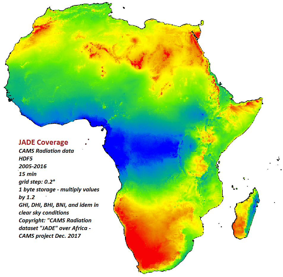
Volume of data (AFRICA)
This volume of data is obsolete. Please use CAMS Radiation Volume over MSG field of view at https://www.soda-pro.com/help/cams-services/cams-radiation-service/download-msg-volume.
You may download this volume from https://www.soda-is.com/pub/files/cams/CAMS-Africa-v3.2.
Copyright: please refer to this volume as "CAMS radiation service dataset "JADE" over Africa computed with McClear version 3.1 and CAMS radiation v3.2
| In brief |
|  Click on the image to magnify |
|---|---|---|
| Grid description | We used a grid of nb_columns*nb_lines = 371*386 points over Africa with a 0.2° step. Only grid cells on land were computed. Download the list of the 2371*386 grid points in CSV format. Grid:
NB: the formula to convert (lat, lon) into grid cell is:
| |
| Volume content | Each HDF5 dataset comprises 35040 maps, which correspond to the number of 15 min periods in 1 year (35136 maps for leap years). Each value in HDF5 files is stored as an unsigned byte:
If you extract hdf5 data as a time series for one location, you will get almost the same data as CAMS Radiation web interface. The small difference is due to the data compression as 1 byte per value in JADE. | 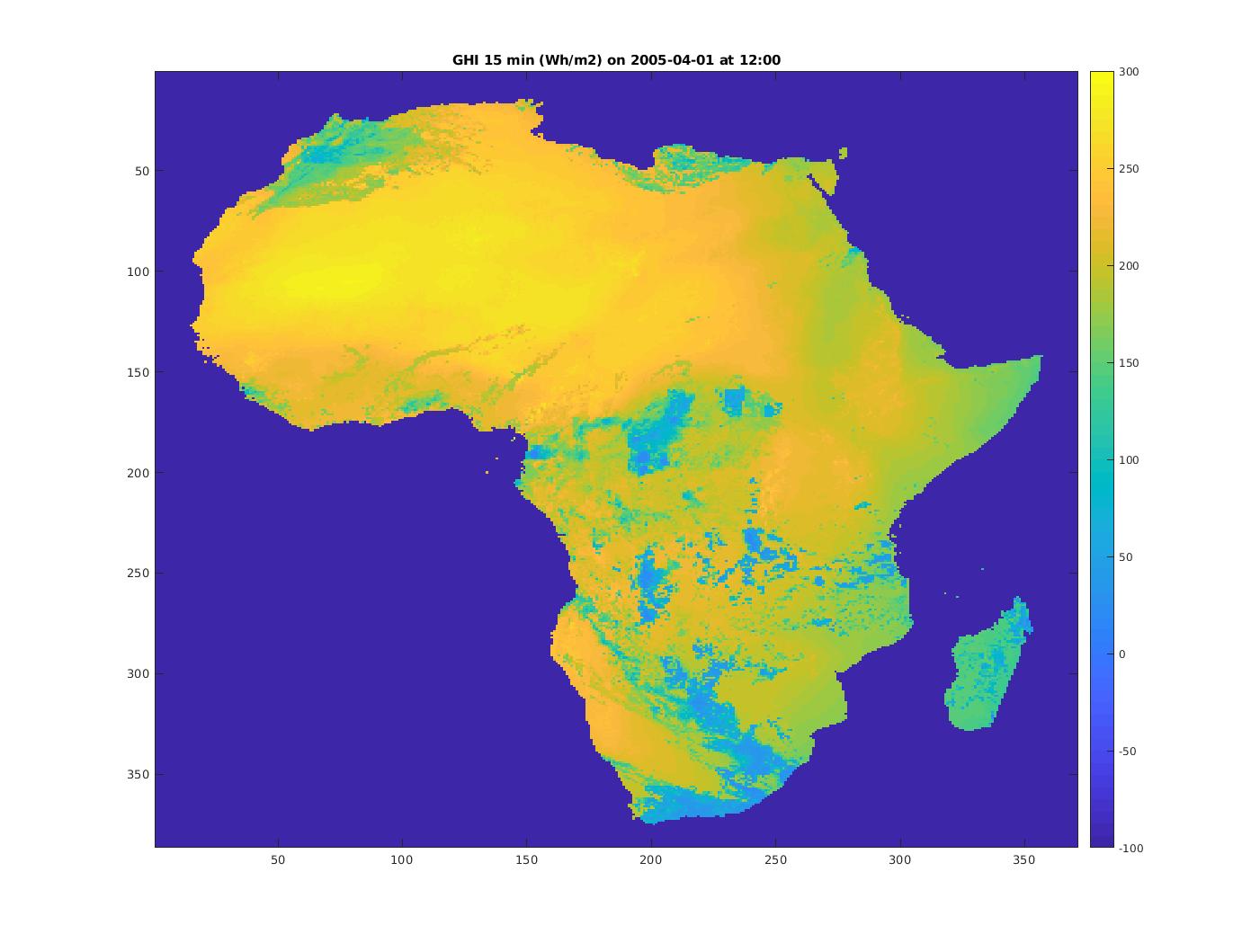 Click on the image to magnify: GHI on 2005-04-01 from 11h45 to 12h00 UT |
| Routines to extract entire or part of JADE | ||
Africa maps "JADE" of CAMS radiation data and CAMS McClear
More info on JADE data - Access to AGATE volume (Europe)
| Radiation Component | DOWNLOAD monthly and yearly maps |
|---|---|
JADE GHI Global Horizontal Irradiation | Download zip-compressed yearly and monthly averaged GHI maps © ARMINES / MINES ParisTech / Vaisala / ECMWF - COPERNICUS Atmosphere Monitoring Service – Monthly and yearly average Global Horizontal Irradiation maps from CAMS Radiation Service over Africa – "JADE" volume |
JADE DHI Diffuse Horizontal Irradiation | Download zip-compressed yearly and monthly averaged DHI maps © ARMINES / MINES ParisTech / Vaisala / ECMWF - COPERNICUS Atmosphere Monitoring Service – Monthly and yearly average Global Horizontal Irradiation maps from CAMS Radiation Service over Africa – "JADE" volume |
JADE Gc Global Horizontal Irradiation in cloud-free conditions | Download zip-compressed yearly and monthly averaged Gc maps © ARMINES / MINES ParisTech / Vaisala / ECMWF - COPERNICUS Atmosphere Monitoring Service – Monthly and yearly average Global Horizontal Irradiation maps in cloud-free conditions from CAMS McClear over Africa – "JADE" volume |
JADE BNI Direct Normal Irradiation | Download zip-compressed yearly and monthly averaged BNI maps © ARMINES / MINES ParisTech / Vaisala / ECMWF - COPERNICUS Atmosphere Monitoring Service – Monthly and yearly average Direct Normal Irradiation maps from CAMS Radiation Service over Africa – "JADE" volume |