
Download Africa volume JADE
Download CAMS radiation data over Africa "JADE" - CONTACT US |
volume of data - maps - Access to AGATE volume (Europe)
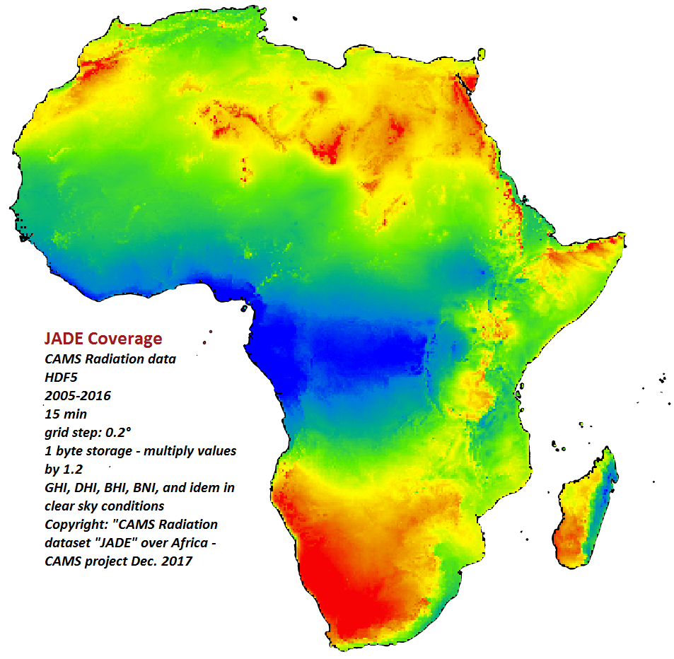
Volume of data (AFRICA)
As the files are too large to be permanently placed on the SoDa server, please contact us so that we can make the data available for a short time period.
Copyright: please refer to this volume as "CAMS radiation service dataset "JADE" over Africa computed with McClear version 3.1 and CAMS radiation v3.2
| In brief |
|  Click on the image to magnify |
|---|---|---|
| Grid description | We used a grid of nb_columns*nb_lines = 371*386 points over Africa with a 0.2° step. Only grid cells on land were computed. Download the list of the 2371*386 grid points in CSV format. Grid:
NB: the formula to convert (lat, lon) into grid cell is:
| |
| Volume content | Each HDF5 dataset comprises 35040 maps, which correspond to the number of 15 min periods in 1 year (35136 maps for leap years). Each value in HDF5 files is stored as an unsigned byte:
If you extract hdf5 data as a time series for one location, you will get almost the same data as CAMS Radiation web interface. The small difference is due to the data compression as 1 byte per value in JADE. | 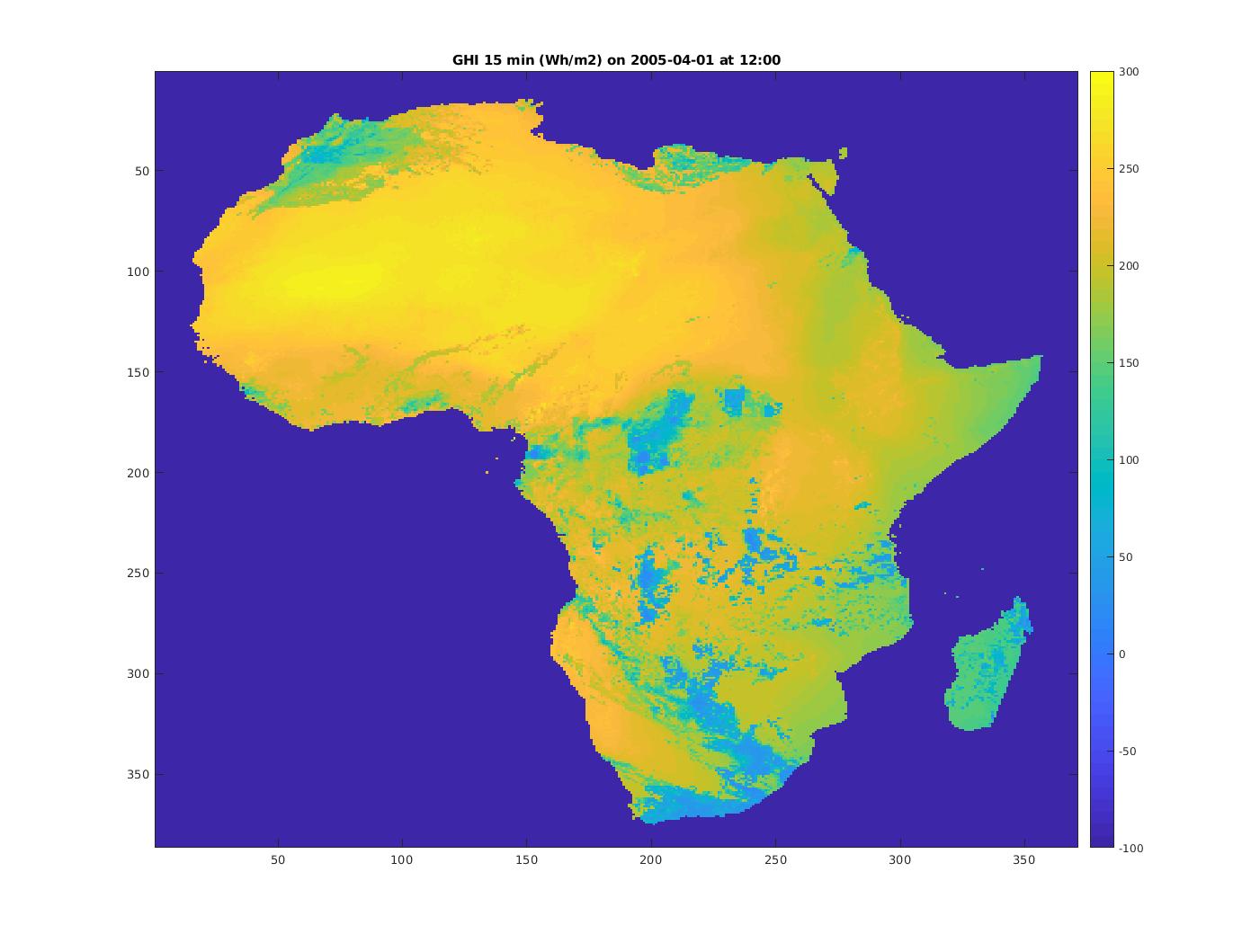 Click on the image to magnify: GHI on 2005-04-01 from 11h45 to 12h00 UT |
| Routines to extract entire or part of JADE | ||
Africa maps "JADE" of CAMS radiation data and CAMS McClear
More info on JADE data - Access to AGATE volume (Europe)
| Radiation Component | DOWNLOAD monthly and yearly maps |
|---|---|
JADE GHI Global Horizontal Irradiation | Download zip-compressed yearly and monthly averaged GHI maps © ARMINES / MINES ParisTech / Vaisala / ECMWF - COPERNICUS Atmosphere Monitoring Service – Monthly and yearly average Global Horizontal Irradiation maps from CAMS Radiation Service over Africa – "JADE" volume |
JADE DHI Diffuse Horizontal Irradiation | Download zip-compressed yearly and monthly averaged DHI maps © ARMINES / MINES ParisTech / Vaisala / ECMWF - COPERNICUS Atmosphere Monitoring Service – Monthly and yearly average Global Horizontal Irradiation maps from CAMS Radiation Service over Africa – "JADE" volume |
JADE Gc Global Horizontal Irradiation in cloud-free conditions | Download zip-compressed yearly and monthly averaged Gc maps © ARMINES / MINES ParisTech / Vaisala / ECMWF - COPERNICUS Atmosphere Monitoring Service – Monthly and yearly average Global Horizontal Irradiation maps in cloud-free conditions from CAMS McClear over Africa – "JADE" volume |
JADE BNI Direct Normal Irradiation | Download zip-compressed yearly and monthly averaged BNI maps © ARMINES / MINES ParisTech / Vaisala / ECMWF - COPERNICUS Atmosphere Monitoring Service – Monthly and yearly average Direct Normal Irradiation maps from CAMS Radiation Service over Africa – "JADE" volume |