
MERRA info
 | MERRA-2 - Web service USAGE | Back to Web service >> |  |
Inputs - Outputs - Correction of temperature with the altitude
Introduction
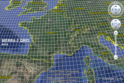
MERRA-2 dataset is a database available worldwide of meteorological variables hosted by NASA and generated by the Goddard Space Flight Center. All results are produced by a numerical weather forecast model (GEOS-5). The spatial resolution is 0.625° in latitude and 0.5° in longitude (approx. 50 km). The manual access via the Web service interface is for free and unlimited. We also provide an automatic access to the data, but this service is for pay. Please for a quotation. All the information to build MERRA-2 automatic commands. What are "reanalyses"? Main publication is Gelaro et al. 2017. |
Inputs
- Latitude and longitude: enter the values in decimal degrees (we advise 3 or 4 digits after comma), or directly click on the map to select your point, or you can also use the "Search Address" tool on the top of the map.
- Start date and End date: format yyyy-mm-dd. MERRA-2 data are available from Jan. 1980 and are regularly updated but available with approx. a month of delay.
Please pay attention to ask for complete months when asking for monthly values. If incomplete, the given monthly value results from an interpolation based on the selected days. - Time step: "1 min", "5 min", "10 min", "15 min", "30 min", "hour", "day", or "month". NB: "1 min" and "5 min" time steps are limited to one month of data per delivery. Original time step of the data is 1 hour.
- Output format: CSV only
Outputs
The output file format is CSV. When pushing the "process" button, wait a while and right-click on the appeared link to retrieve your file. Here is the output column content:
- Temperature (K): temperature at 2 m above ground in Kelvins (K)
- Relative humidity (%): Relative humidity at 2 m above ground in percent (%)
- Pressure (hPa): Pressure at ground level in hPa
- Wind speed (m/s): Wind speed at 10 m above ground in m/s
- Wind direction (deg): Wind direction at 10 m above ground in degrees (0 means from North, 90 from East...). Where does the wind come from.
- Rainfall (kg/m2): Rainfall (= rain depth in mm)
- Snowfall (kg/m2): Snowfall
- Snow depth (m): Snow depth in meters
- Global Horizontal Irradiation (Wh/m2): Irradiation over the period in Wh/m² (-999 if no data)
Please find here more characteristics of the output data:
- Data are in UT
- The hypothesis of integration is "end of interval": e.g. hourly data at 11:00 means data averaged over 10:00 to 11:00
- Missing data: -999. For the time step configured for "minutes", the last accessible month's last data might be the -999 value.
- for a given location results from a bilinear interpolation of the values of the 4 closest MERRA pixels. Original time step is the hour.
- No altitude correction applied to the meteorological parameters retrieved by using this service.
- Wind speed and direction are not directly provided by MERRA, but computed from the "u" and "v" vectors of wind speed. As the formula are not linear, please note that the monthly (or daily) values computed from the hourly values of wind speed are different from the monthly values retrieved from the Web service interface.
- Same remark for the relative humidity parameter, computed with a non-linear expression from pressure, temperature and specific humidity.
- Other variables (pressure and temperature) are linear.
Correction of the temperature with the altitude
By default, the temperature is given for the altitude of the MERRA-2 pixel (approx. 50 km of spatial resolution), available in the 6th headerline entitled: "# Site altitude" in the retrieved output CSV file. It is possible to modulate the temperature with the actual altitude of the selected point with for instance the altitude contained in the Digital Elevation Model SRTM (approx. 100 m of spatial resolution) to take into account the decrease of temperature with height. Here is the equation (Wikipedia):
Temperature_corrected (C°) = Temperature (K) - 273.15 - 0.65 * (Altitude_SRTM - Altitude_MERRA2) / 100;